


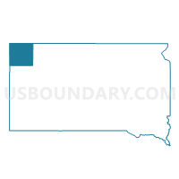
VTD-precinct Vessel, Harding County, South Dakota
About
Outline

Summary
| Unique Area Identifier | 667364 |
| Name | VTD-precinct Vessel |
| County | Harding County |
| State | South Dakota |
| Area (square miles) | 103.70 |
| Land Area (square miles) | 103.59 |
| Water Area (square miles) | 0.11 |
| % of Land Area | 99.89 |
| % of Water Area | 0.11 |
| Latitude of the Internal Point | 45.88546950 |
| Longtitude of the Internal Point | -103.17992220 |
Maps


Graphs
Select a template below for downloading or customizing gragh for VTD-precinct Vessel, Harding County, South Dakota


Neighbors
Neighoring Voting District (by Name) Neighboring Voting District on the Map
- Bowman 39-02 Voting District, Bowman County, ND
- Bowman 39-04 Voting District, Bowman County, ND
- VTD- precinct Ludlow, Harding County, SD
- VTD-precinct Fillmore, Harding County, SD
Top 10 Neighboring County Subdivision (by Population) Neighboring County Subdivision on the Map
- North Harding UT, Harding County, SD (548)
- Goldfield township, Bowman County, ND (35)
- Minnehaha township, Bowman County, ND (24)
- Haley township, Bowman County, ND (23)
Top 10 Neighboring Unified School District (by Population) Neighboring Unified School District on the Map
- Bowman County Public School District 1, ND (2,714)
- Harding County School District 31-1, SD (1,255)
- Scranton Public School District 33, ND (868)